Thursday, August 17, 2006
Change
Wednesday, August 09, 2006
Strange day
Tuesday, August 01, 2006
Spectacle Lake
The four and a half miles to Pete Lake is just long and flat, nothing to look at, and the mosquitos never let up. I stopped by the shore of Pete Lake for a drink and a snack, swatting at everything that moved, and headed up.
Just after Pete Lake the mosquitos thinned out. When I got to the Lemah Creek crossing, I saw how high, fast, and wide it was and decided it would be wise to add the extra 3/4 mile trip on the Lemah Meadows trail to join the PCT and take the footbridge route. Some of the PCT is a little overgrown, and some of the growth is Devil's Club. The rest of the overgrowth is just wet and full of spider webs. It was actually nice to get soaked walking through that - it was a nice cool-down.
Miles later of more uneventful trail and I finally hit the switchbacks up to the lake. Again, no views, but there was one rather fantastic, crashing waterfall that looked like something you'd see in Vegas or Disneyland.
Right after that is the one big blowdown. A huge dead tree fell over the trail. You can't go over or around it, so you have to crawl under it. With a day pack, it might be a little more navigable than with an overnight pack. Over the whole trail, I saw one group of about 8, one other solo hiker, and two couples. All of them were going in the opposite direction. I was hoping for a lack of crowds, and I got it.
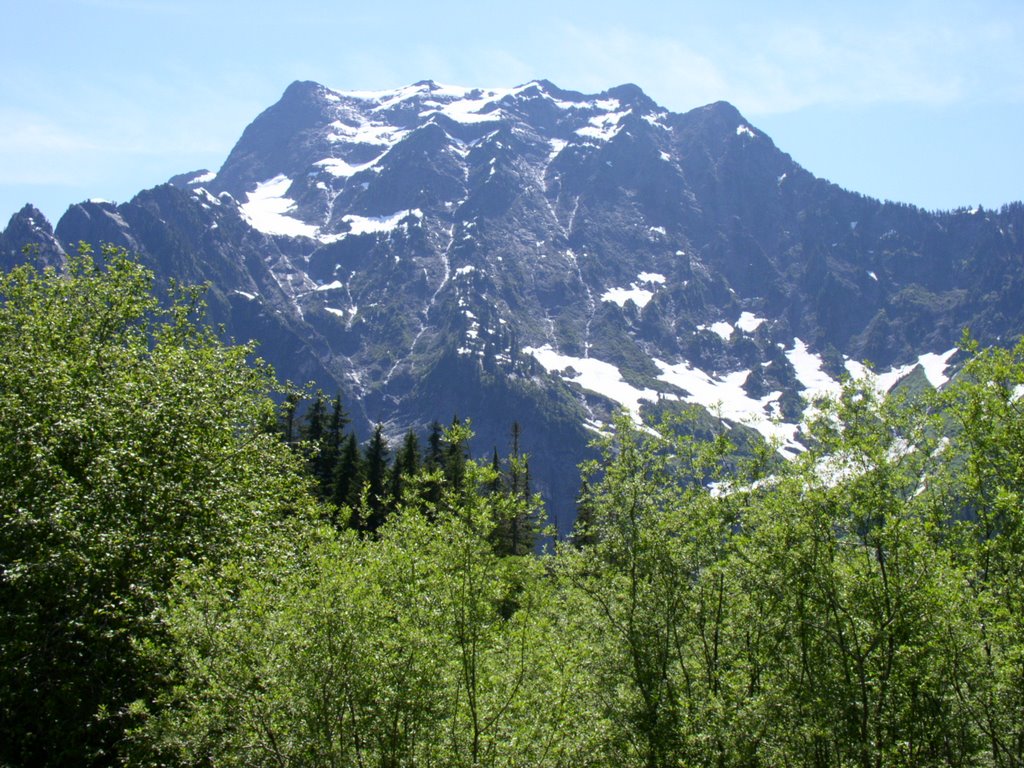
Finally, at long last, I got up to the first views of Three Queens and the peaks surrounding Spectacle Lake. It took me about 6 hours between leaving the car and getting to the lakeshore. I made my way down to the lake to find that I was alone and had my choice of campsites. I wandered down the first shoreline reached by the trail and did not find what I wanted. I went around the South shore and then North onto the large peninsula and found a campsite near the end with a view of the Western portion of the lakes and the peaks surrounding it: Huckleberry Mountain, Chickamin Peak, and Lemah Mountain. Heavenly!
Eventually, two other campsites were tak en, and there was a group of 4 that fished and left, and one other solo hiker who stayed for a short time and left. The lake was very quiet.
I set up camp and ate lunch, then set out to find the trail to Glacier Lake. No such luck. I went back to camp and relaxed and took in the veiw, had a swim, watched the fish and the ducks, and relaxed some more. The cloud cover broke breifly a few times. The temperature hovered around the mid-nineties, but when the sun broke it shot up to 103. That gets a little uncomfortable, but that's what alpine lakes are for. The sunset I hoped for did not materialize - too many clouds. It was nice, but not... well, not spectacular. I finally crawled into my tent and passed out. A deer woke me up around midnight, crashing around in the campsite, looking for leftovers or something.
I did not go up to Spectacle Point due to time and energy constraints (after hunting for the Glacier Lake trail for too long), but word is that there are still a couple of nasty snowfields on that portion of the PCT.
When I woke up this morning, it was already 64 degrees. I ate and packed out, taking one last look for that Glacier Lake trail - for next time. I left the lake at about 6:30 and got back to the car, 11 miles later, at 11:15 and 88 degrees. I must have been in a hurry to get through the skeeters. I saw only 8 people on the trail this morning, all on their way up to Pete Lake.
Sunday, July 30, 2006
Tuck and Robin
I decided to hike Tuck and Robin. I had done it before, but this weekend’s weather forecast wasn’t great and I didn’t want to waste a marginal-weather weekend on a new hike. My pictures from the previous trip were great, and I felt no need to improve on them. I figured if my pictures from this trip didn’t turn out it wouldn’t matter.
I got to the trailhead early and started out at a very slow pace, knowing what was in store ahead. The first several miles are nearly flat, and they lull you into a false sense of security, making you think you can go full-speed. That just wears you out. The last two miles of the trail are a nightmare of roots, rocks, gravel, and straight up climbing – sometimes with a trail, sometimes just scrambling up over rocks marked by cairns.
First error: wrong boots. I chose the boots for this trip because I wanted good ankle support. These boots used to work just fine for me, but for some reason they don’t anymore. Last time I wore them I got a blister, and this time was no different. The best thing to prevent a blister that I have found is duct tape. As soon as you have a hot spot, slap on some duct tape. However, I didn’t have any this time. To prevent a blister, I tightened up my laces and changed my pace. That hurt my ankles, but it was better than a blister. So now, my ankles are swollen and bruised.
The trail from the turnoff from the Deception Pass Loop trail up to Tuck Lake sucks. There’s really no other way to put it. It sucks out loud. As I said above, rocks, roots, gravel, straight up. I hate it. I got to Tuck Lake after seeing only two people on the trail. Tuck is a beautiful lake with a little island that looks like it should have been in Myst or Riven or one of the Lord of the Rings movies. It is a little barren and primeval while being lush and colorful at the same time. It looks a little unreal, especially in sunlight, especially since the water is so clear and so blue that you can see all of the rocks under the water and watch the fish. I stopped there for a break and headed up to the Robin Lakes.
The trail past Tuck Lake and Tuck’s Pot gives a nice preview of what the trail is like all the way up to the Robin Lakes. If you follow the trail closest to Tuck Lake, you end up climbing up, over, down, and around until you get to the logjam, which you cross to find the trail on the other side. Then you do some more climbing up and over and down and around, eventually with great views of Tuck’s Pot and Mt. Daniel, until you reach the end of Tuck Lake. That’s when you start climbing in earnest. It is about 900 feet of elevation gain from the end of Tuck Lake up to Lower Robin Lake. And it isn’t even a mile.
Up, up, up. Roots, rocks, handholds, footholds, up, down, around, through, follow that cairn, brace yourself here, haul yourself up with that branch, stick your foot up against that tree trunk while you jam your pack into that crevice for leverage and pull yourself up with your fingernails, don’t take that trail because it leads to a cliff, follow that cairn up there instead and then spot the next one. Eventually you run out of trail and all you have left is big, broken slabs of granite that you walk straight up. Not to the left – that gives a very difficult gully to climb down to get to the lake. Not to the right – that just leads to the end of the lake and adds time and distance. Follow the cairns up the middle. You see two really big cairns next to each other, like a gateway to the land of the cairns. After that, all bets are off. You can go any way you want to. Some of the cairns on the left lead to a trail that takes you down to Lower Robin Lake. Others just lead you around the end of the lake, which is great if that is what you want. Other cairns were placed for fun or some other inexplicable reason.
My welcome back to the lakes consisted of seeing the gateway cairns and a goat sticking its head out from behind a rock. Yay, goats! That is what I was hoping for. I climbed up the knob at the outlet of Lower Robin Lake, overlooking Cathedral Rock, Mt. Rainier, Mt. Daniel, Granite Mountain, and Mt. Hinman, and set up my campsite. The goats joined me shortly thereafter. I think I had 8 or 9 of them with me for a while.
Second error: For the record, that partly cloudy forecast was direly incorrect. There wasn’t a cloud anywhere over the Robin Lakes. But it was only in the low 70s, so it didn’t occur to me to put on sunscreen. You can guess what I’m leading you to. So anyway.
After the long and tiring trek up to the lakes, I was tired. I decided to whip up some chicken and rice for dinner. I boiled the water, poured the two cups of water into the freeze-dried food bag, and sealed it. I waited my 8 minutes for my lovely hot dinner. I opened up the zippered bag… and 8 or 9 little goat heads whipped around to stare at me. They could smell the salt. Uh oh. Two of the biggest goats stood up. They sparred a bit to determine who would dine on chicken tonight. The biggest one won and came at me. I backed away, telling the goat that good goats don’t eat chicken and rice, it is bad for their cholesterol levels and that goats are vegetarians and wouldn’t like my dinner. It didn’t work. Finally, the goat had me cornered and was about 3 feet from me, and like a moron I decided to treat him like a dog. I pointed at him and said “NO!” in a rather harsh tone. He blinked and gave me one of those, “I’m sorry, I don’t know what came over me” looks and walked back to the herd and lay down. Hmmm. Interesting. Can goats really have facial expressions? Probably not, but that’s how I chose I read it.
As it cooled off, the wind picked up. The temperature started dropping rapidly. I watched the goats for a while, watched the lake for a while, and watched the sun setting for a while. I saw what I think was an eagle catching a fish and fly away toward the South. I read my book for a while and had a victory beverage. It got colder. And colder.
Third error: I made a stupid assumption. All of the other hikes I’ve done this year had temperatures above 60 at night. I assumed that this one would be no different. On the last several hikes, I took my North Face Blue Kazoo sleeping bag, which is good down to 30 degrees. Way too hot. So this time, I took my summer weight bag, good down to 55 degrees. The nighttime temperature fell to 41 degrees. I had all of my clothes on in my tent in my sleeping bag and I couldn’t sleep because I was shivering too hard. I was worried that I would end up hypothermic. Luckily, I was just very uncomfortable and ultimately undamaged.
I got up this morning and it was still in the 40s. I decided that I would not be staying another night because I didn’t have my good sleeping bag, and instead I would go visit the Granite Mountain Potholes after eating breakfast, then I would pack out. The Potholes are a little series of tarns just past Upper Robin Lake. I tried to light my stove to boil water.
Fourth error: your mileage may vary with stove lighting methods. I carry a lighter. Before each hike, I shake it to see how much fuel is in it. There was plenty. Today, I couldn’t get it to light. I think the flint was worn down, I don’t know. I had a brief panicky moment where I thought I would have to ask another camper for a light (so gauche, such a n00B move), and then I remembered that for the first time ever, for no discernable reason, I had packed matches! I dug them out of my first aid kit (Why there? I don’t know.) and got the stove lit on the second try. I had a nice hot oatmeal breakfast and started cleaning up the camp.
Back to the goats. The first time I was up there, they weren’t the least bit aggressive. They are now. I had them following me around regularly because they were waiting for me to pee. They want the salt. Yes, it’s gross, but that’s the way it works. I had to keep shooing them away. At one point while I was getting ready to go off to the Potholes, I was walking past a goat and her kid, and I was giving them plenty of space. And yet, she came at me like she was going to headbutt me, and then stomped her feet at me. I stomped back at her before realizing that I might be accepting some kind of a challenge, but she just gave me a “pardon me, I must have lost my mind for a moment there” look, and she left.
I headed for the Potholes. They’re pretty easy to find, but the trail isn’t exactly great. If you follow the trail around Upper Robin Lake, you see there are a number of trails. They eventually converge into one very narrow, steep track that drops straight down part of the shoreline, then becomes easier and heads up to the Potholes. However, there’s still quite a lot of snow up there. It is very hard packed and slick, so I gave up trying to walk on it and headed up the rocks to the left. You can follow some good game trails. It is an interesting little area. I think the flora is a little different from what is around the lakes, and it is very quiet. I could see no campsites, but there may be some under the snow. After wandering for a short time, I decided to pack out and I headed back to the campsite.
I got everything packed up and got the pack on my back. I turned to take one last look at the lakes. It is so pretty up there. I really love the area. I felt so bad about leaving so soon, but I will just have to go back someday. I miss it already. Away I went.
The trip up the trail to the lakes is bad. Going down that trail is even worse. You get winded and fatigued going up, but your joints take a terrible beating on the way down. I made it to Tuck Lake in about an hour, and my knees were bothering me. A short way past Tuck Lake, my right knee and hip decided they didn’t want to play anymore and they took their ball and went home. I struggled for a while, favoring my right leg, mostly using my left leg and relying heavily on my trekking poles. Eventually they came back to play, but they pouted the rest of the way down. Then my left knee decided it wasn’t happy anymore either. By the time I got back to my car, both my legs were pissed off, stiff, sore, creaky, and weak. Driving home was a great treat. I’m hoping they recover by Monday, but I may be asking for too much.
To sum up: stunning alpine lakes, glacier carved basin, mountain goats, wild flowers and heather, fantastic weekend. Did I mention mosquitoes? No? That’s because there were none! Make that a perfect weekend.
Monday, July 17, 2006
Friday, July 14, 2006
Yet another media frenzy
Thursday, July 13, 2006
"Do you guys wanna see a dead body?"
The commute was less than uneventful today. It was far too eventful.
I pulled into the parking garage and noticed two cops sitting across the street. I thought that was a little odd. Then I noticed that the garage was nearly empty. I thought that was a little odd, too. I saw people standing on the platform with the guards, so I figured it was just one of those days when people were taking a later train or just not going to work. I heard a train whistle right about the time I was going to get out of my car, and decided that it would be prudent to take the skybridge to the platform instead of trying to cross the tracks, because I didn't want to get stuck on the wrong side of the tracks if it was a big freight train coming. As I walked to the skybridge, I saw a freight train parked on the tracks below. I thought that was a little odd as well. After reaching the platform, I found out what happened.
Yet another train hit and killed yet another pedestrian in Kent.
The big freight train that was sitting on the tracks was the train that hit the person. The person was crossing the tracks where there was no actual crossing, just South of Highway 18, and somehow missed the gigantic train with the blaring 110-decible horn and the blinding Cyclopean headlight bearing down on them at 30-50 miles per hour on the flat straight-away through Kent. (My tone may indicate to you that I think this person was a moron. You would be right to infer that.)
The freight train, naturally, had to stop. The freight train was so long that it was blocking at least two streets that cross the tracks, so I'm sure Kent traffic is something of a nightmare this morning.
The body, unfortunately, was under the train when it finally managed to stop 1/2 mile later. It was a very long train. They unlinked the cars near the body and pulled the engine forward so that they could get at the body, which was covered with a white sheet or blanket when we passed. Naturally, the Sounder train audience ooh-ed and ahh-ed when they saw it. Morning commuters love a drama.
Welcome to Thursday.
Wednesday, July 12, 2006
Jake Shimabukuro
Monday, July 10, 2006
Rachel, Lila, and the Ramparts
Thursday, July 06, 2006
Fourth of July
Monday, July 03, 2006
A little jaunt into the wilderness

Yesterday I hiked the 11-mile round trip to Navajo Pass, at about 6000 feet. If you like up-close and personal looks at the likes of Mt. Stewart (at left), you should to this hike. If you like a raging river, open landscape, gnarly trees, wildflowers, hot hot heat, and a distinct lack of biting bugs, you should do this hike. Campsites? Check. Breeze? Check. Deer? Check. Plenty of water? Check. Stunning vistas? Check. Crowds? Unfortunately, check. There were 7 tents at the pass, and I counted 9 people on the way in and two on the way out. I suppose that isn't technically crowded... Anyway, nice hike, only 3000 feet of elevation gain over 5 1/2 miles. The trail is in good shape in spite of horse use. It is very pretty and very different than Western Washington hikes - it is litteraly barren in spots, particulary just below the pass on the South slope. It looks like the moon. I'll write a more detailed "trip report" later if I feel like it, but I have homework to get to.
Wednesday, June 28, 2006
The influence of co-workers
Tuesday, June 27, 2006
One thing leads to another
Monday, June 26, 2006
Fortune cookies
I eat a fortune cookie every day. No reason why, other than that I like them. I don't believe in the fortunes, but I get a chuckle out of how positive and upbeat they are. The last three I've gotten:
You will be sucessful in romance.
You will inherit some money or a small piece of land.
You are domestically inclined and will be happily married.
The irony here is that only the middle one stands to come true.
On the other hand, there's a website that offers more realistic alternatives to fortunes. http://www.new-year.co.uk/chinese/cookie.cfm
Sunday, June 25, 2006
Mt. Forgotten
Left: Big Four, view from Mountain Loop HighwayOn Friday, I did the first real mountain climbing I've done this year. I hate to be a mountain snob, but anything under 4,000 feet is not a real mountain. I'm sure there are others who feel than anything under 6,000 or 8,000 or 10,000 aren't real mountains, so at least I'm not as restrictive as others.
Left: Perry Creek crossing at 2 milesAfter checking every website I know to find trip reports, I decided on Mt. Forgotten. Last time I was up there was right around 1998, and (pardon the bad joke) I had forgotten just how spectacular it is. It isn't the most difficult hike at 3.5 miles each way and about 2000 feet of elevation gain to the meadows, but the trail isn't in the best condition in spots. That much I did remember. I left home early and got to the trailhead at about 6:30. I'm very slow. I take a lot of pictures. I took 147 on this trip. That could be, in large part, why it took me 4 hours to reach the meadows. However, I will concede that I take a lot of breaks and I am not in good condition. Once the asthma and the allergies kick in, I can't breathe and I get pretty fatigued, so I would go slow even if I didn't have the camera.
Left: PikaI didn't see much in the way of wildlife. I saw some pikas, some chipmunks, some birds, some bugs, some slugs. That's about it. I did hear a woodpecker at one point in the forest, and I heard a grouse or a ptarmigan while I was up in the meadows overlooking the peak, but hearing things counts for nothing.
Anyway, the waterfalls off of Mt. Stillaguamish are visible and audible from across the valley. They're pretty impressive. Perry Creek is a little tricky to cross because the big log that used to make such a great bridge has collapsed partially into the creek, so you get your feet a little damp on the way to the other side. There's quite a difference in the trail before and after the Perry Creek crossing. Before you cross the creek, you're traversing the shoulder of Mt. Dickerman in an open valley. The trail is a little rocky in spots, but not very steep. It is very warm in that valley. You have a view across the valley and up the shoulder of Mt. Dickerman, not to mention back down the valley toward Big Four, the whole time. The moment you cross the creek, you're in the woods. No views, cooler, quieter. The trail gets steeper and rocks are traded for roots. The camp robbers show up if you take food out.
There is still some snow on the trail, but I managed to stick pretty close to it by following the footprints of others, the blazes on the trees, the red trail maintenance flags, and the logs that had been cut apart where they had fallen and obstructed the trail. Just below the first viewpoint, you hit the solid snow. It is packed down pretty hard and is a few feet deep, so I wasn't postholing through it at all. I got to the viewpoint and snapped a few shots of Mt. Forgotten, Mt. Stillaguamish, White Chuck, Mt. Baker and Mt. Shuksan. I chatted for a moment with a guy who had camped there the night before and headed up to the meadows.
After the viewpoint, the trail is a little harder to follow. The snow is patchy in the trees, but the footprints are harder to follow and there are no other real signs of the trail. Still, if you just keep those cliffs in view to the left, you get to the meadows.
The meadows are currently solid snow. It is very pretty, and there has been so little traffic up there this year that the footprints are nearly invisible. I had the meadows entirely to myself. I glissaded down one slope just for kicks before heading up to the real views. From the meadows proper, you can see Three Fingers, Whitehorse, White Chuck, Glacier Peak, Mt. Forgotten, Sheep Mountain, Mt. Dickerman, Big Four, Mt. Baker, Mt. Shuksan, and many others too numerous to name. It is spectacular. I plopped down in the snow with Mt. Forgotten to my left and Glacier Peak in front of me to eat lunch. I stuck my apple and cheese into the snow to let them cool off while I ate my beef jerky chunks and took off my outer layer to cool down. My lily-white shoulders turned very, very pink. Stretched my legs, relaxed, took in the view. Then I ate my ice-cold apple and cheese.
Here's where I got stupid. I wanted to go out to the rock outcrop with the best view of Mt. Baker. I didn't make it, but I tried. The path, even in the best of circumstances, is steep and treacherous, and right now it is partially obscured with snow. I slid down the slope to the one very small patch of dirt that I could see of the trail, then went about 10 feet to the big patch of snow that is obscuring the rest of the trail. My intention was to climb over that snow, but from that angle I could see that it was very thin. I chickened out and turned back. Kickstepping back up that slope was not easy - it was about 12 feet up and very steep, probably a 60 degree angle. I finally made it back up and decided it was time to head back home.
The trip down was uneventful until I reached the second creek crossing. Trail maintenance folk from the WTA had showed up and they were working on the trail. At that moment, they were building a rock "bridge" to cross that creek. I walked over, complimented them on their handiwork, chatted for a moment, and headed out.
My second mistake of the day was to try to take I-405 home. I drove in first gear - when I was actually moving, that is - for an hour before finally making it to the I-90 exit. Next time I'm hiking in the North Cascades, I'll take highway 2 or 20 over the passes and drive South on the other side of the state, then take the Mt. Rainier loop to get home. It might add some miles, but it will probably take less time and the veiw will be more enjoyable.
Anyway, the day was fantastic. I highly recommend this hike. Blogger won't let me upload more pictures, so you can find all of them on Webshots.
Thursday, June 22, 2006
Plans so cunning you could put tails on them and call them weasels.
Wednesday, June 21, 2006
Definitely stalker material
Tuesday, June 20, 2006
What time is now?
Saturday, June 17, 2006
The children are our future...
Yesterday was one of those days that I really wish I had my camera with me so that I could prove this. I got stuck behind a car in Renton traffic yesterday (it took me an hour to drive the 20 miles from SeaTac to Maple Valley) that had four young'uns in it. Newly graduated young'us, I'm guessing. On the back window someone had painted That's how bright they are.
Class of 2"06"
That's how bright they are.